At ICEM, maps are strategic tools that inform climate adaptation, environmental planning, and ecologically sustainable development. Through geospatial analysis, remote sensing, and spatial modelling, we uncover risks, opportunities, and patterns across complex landscapes.
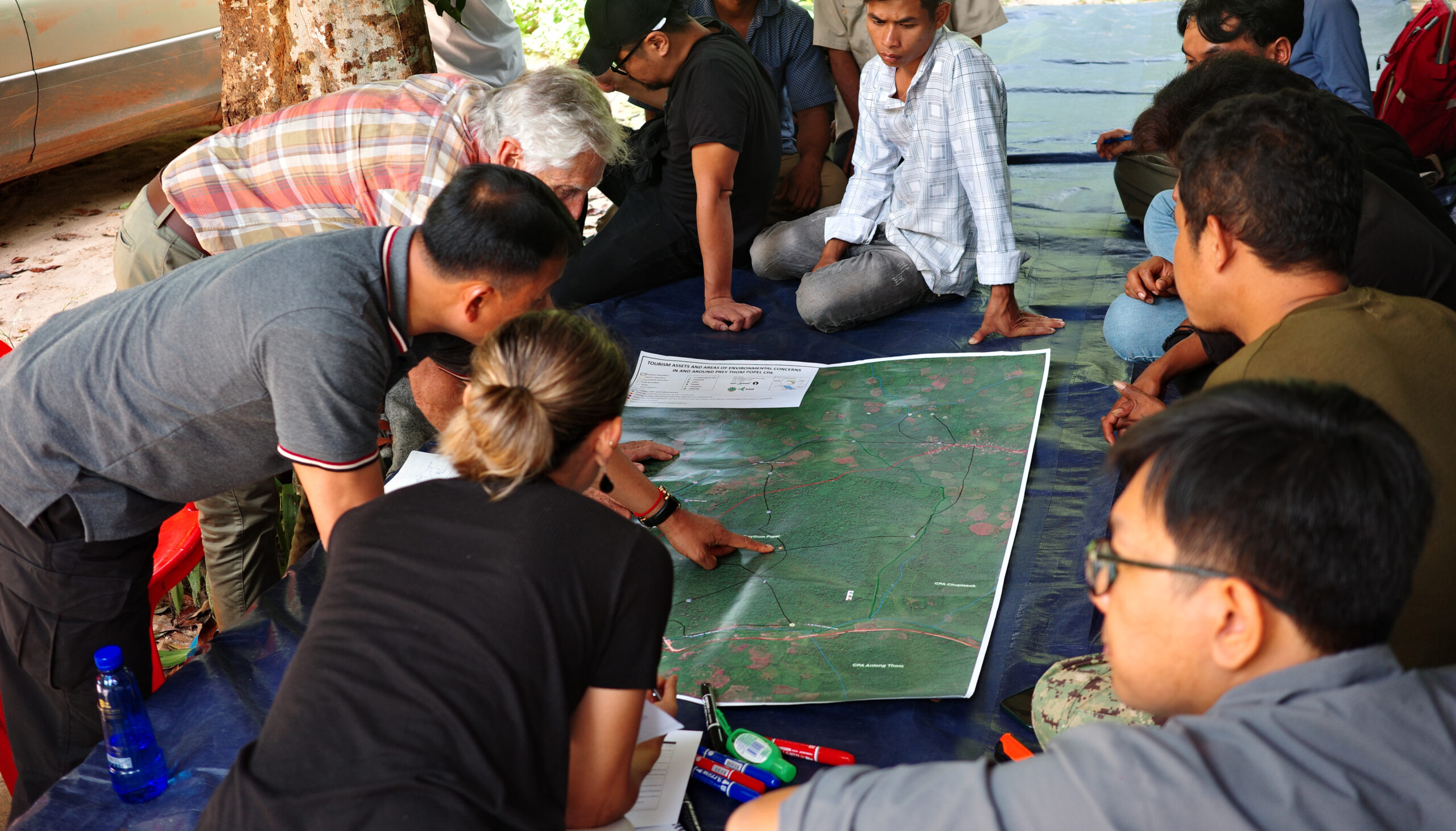
Our mapping integrates scientific data with local knowledge to support evidence-based decision-making. From identifying erosion hotspots in the Mekong Delta to mapping biodiversity corridors in northern Laos and assessing flood risk in Central Asia, ICEM’s spatial work equips governments, development partners, and communities to plan for a more climate-resilient future.
We specialize in mapping ecosystem services, climate vulnerabilities, and nature-based solutions to support ecosystem-based adaptation. Our tools (e.g., including interactive atlases, scenario models, and spatial risk assessments) are participatory, policy-relevant, and grounded in real-world needs.
The maps featured here showcase ICEM’s work across sectors and regions. They reflect our commitment to inclusive planning and the power of spatial thinking to solve environmental and climate challenges.
At ICEM, we believe better decisions begin with better understanding. And maps and spatial analysis provide the lens through which we see, share, and shape that understanding.
Climate Change, Decision Support Systems, Environmental Economics, Water
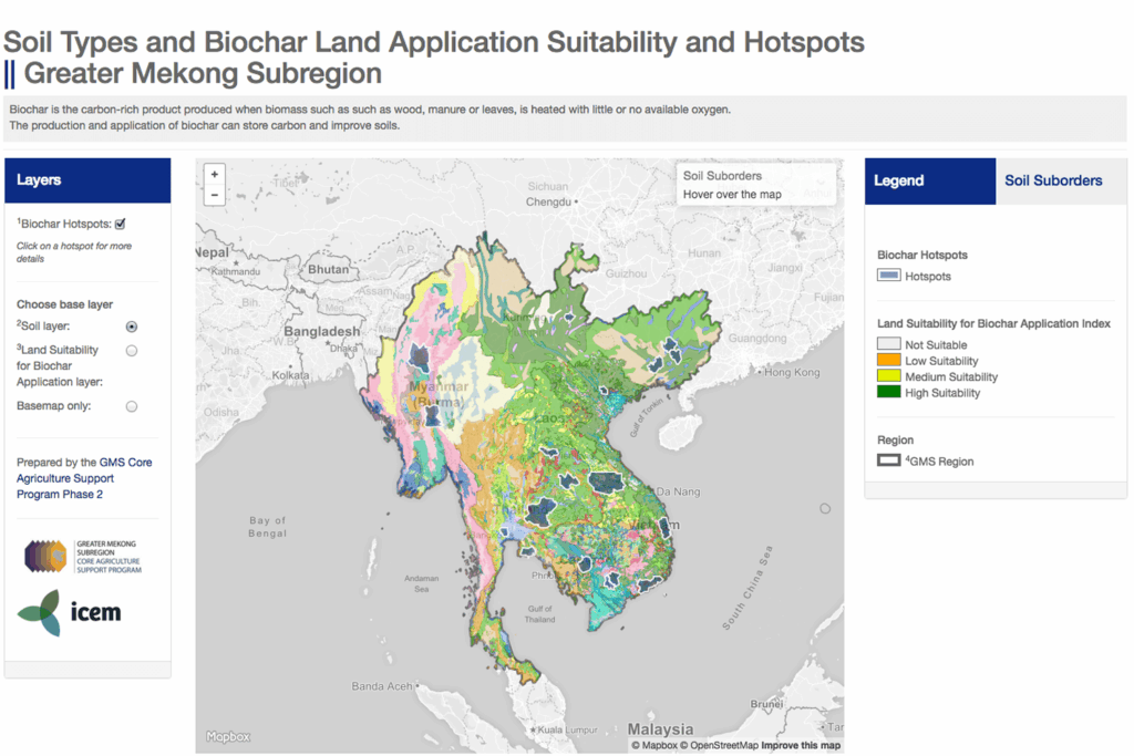
PROJECT NAME: ADB Biochar Assessment and Soil Mapping Study About the project ICEM developed an interactive map of soil types and biochar suitability as part of the ADB-funded Biochar Assessment and Soil Mapping Study. The map allows users to switch between detailed soil classifications and biochar suitability zones, covering the Greater Mekong Subregion.
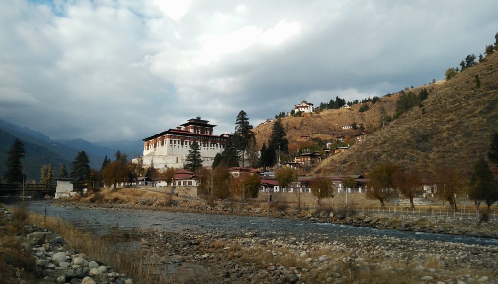
Project Description To strengthen its disaster preparedness, the Royal Government of Bhutan (RGoB) launched the Disaster Preparedness Pilot Project (DPPP) in collaboration with the Gross National Happiness Commission, Department of Disaster Management (DDM), and the Swiss Red Cross. Despite a multi-stakeholder approach to disaster risk management, critical gaps remained in contingency planning, emergency response systems, […]
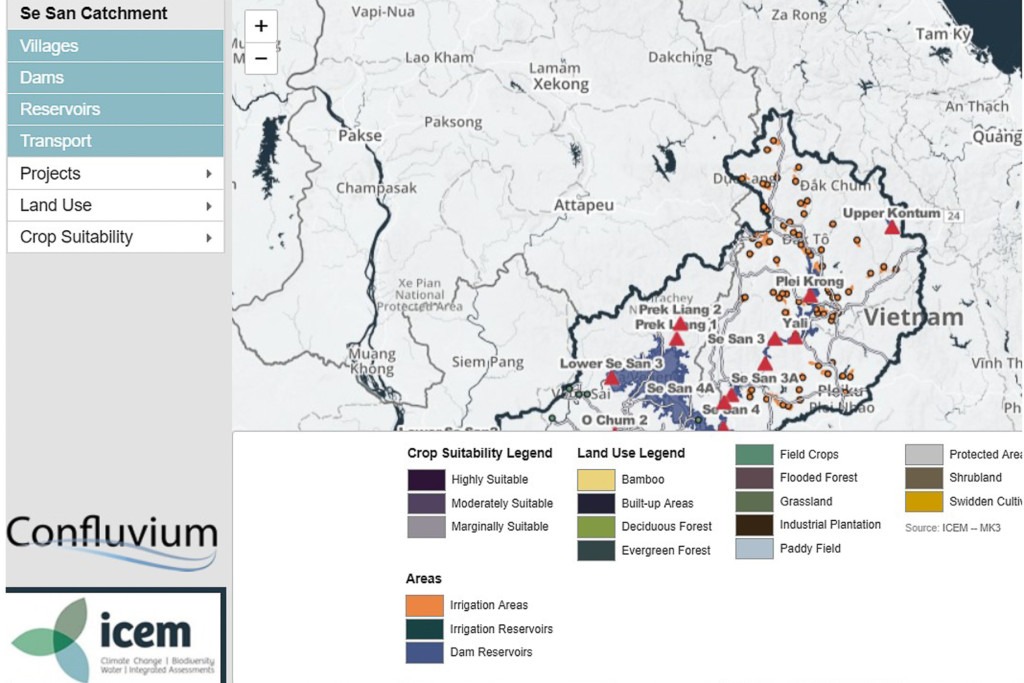
These maps were produced as part of a three-year research program, MK3: Optimising Cascades or Systems of Reservoirs in Small Catchments. The project took place from 2010 and 2013 in two river basins, tributaries of the Mekong – the Nam Theun/Nam Kading in Lao PDR and the Sesan River in Viet Nam and Cambodia, divided into […]
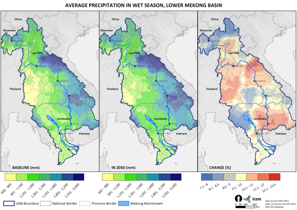
Much of ICEM’s work on the Mekong ARCC project hinged on climate modelling and maps created by ICEM’s GIS team. These maps covered temperature and precipitation projections for the Lower Mekong Basin. A selection of the precipitation maps are displayed below. Click on the map to download a high-resolution version.