GIS and Spatial Analysis

Mapping the Path Forward

ICEM applies Geographic Information Systems (GIS), remote sensing, and spatial analysis as core tools across its work in the Asia-Pacific region. These capabilities support a wide range of services, including environmental assessment, climate risk mapping, disaster risk reduction, ecosystem valuation and restoration, infrastructure planning, and integrated river basin management.

With 27 years of regional experience, ICEM combines advanced geospatial technologies with scientific and participatory methods to develop tailored decision-support tools and spatial planning frameworks. From high-resolution mapping and predictive modelling to the design of custom web applications and data systems, ICEM’s geospatial services help clients understand complex socio-ecological systems and prioritize action—from basin-scale planning to village-level land use decisions.

Tools and Technologies

ICEM draws on a robust suite of proprietory and open-source platforms to deliver spatial solutions that are accurate, adaptable, and tailored to each project’s needs. Our team leverages industry-standard and cutting-edge technologies across the full geospatial workflow:

  • GIS Software: ArcGIS (Desktop and Pro), QGIS, MapInfo, SAGA GIS
  • Remote Sensing Platforms: Google Earth Engine (GEE), ERDAS Imagine, ENVI, eCognition
  • Modeling Tools: SWAT, HEC-HMS, HEC-RAS, WEAP, CROPWAT, RUSLE, land use suitability models
  • Programming & Automation: Python, R Shiny, SQL, ModelBuilder
  • Databases & Web Services: PostgreSQL, PostGIS, GeoServer, Leaflet, MapServer
  • Cloud & Mobile Platforms: KoboToolbox, ODK, Fulcrum, Google Cloud Platform
  • CAD Integration: AutoCAD, MicroStation
  • Earth Observation Data: Sentinel-1/2, Landsat-8/9, MODIS, RapidEye, SPOT, UAV imagery

Technical Services

ICEM offers a comprehensive range of GIS and remote sensing services designed to generate actionable insights and support informed decision-making:

  • Spatial Data Collection and Management – From data acquisition to database design and quality assurance
  • Spatial Analysis and Modeling – Including suitability analysis, change detection, and predictive modeling
  • Cartography and Data Visualization – High-quality, publication-ready maps and interactive dashboards
  • Remote Sensing and Image Analysis – Land cover classification, feature extraction, and vegetation monitoring
  • WebGIS and Application Development – Custom platforms for data access, analysis, and stakeholder engagement
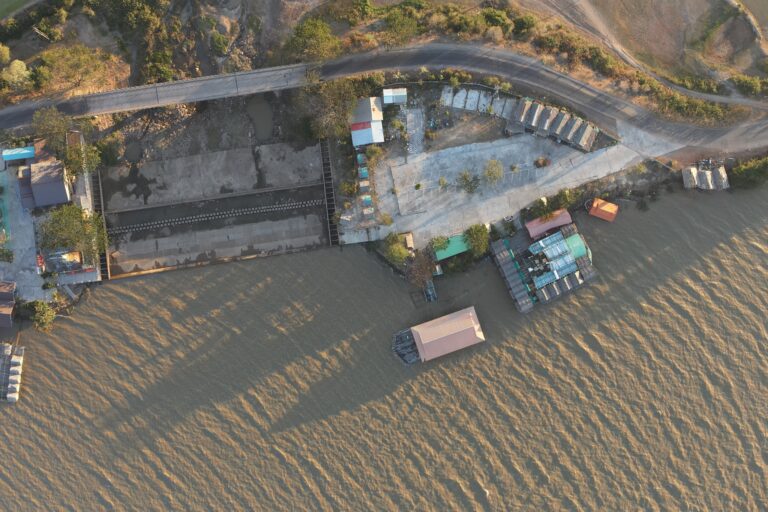
  • Drone-based Surveying and Analysis – High-resolution terrain models, multispectral analysis, and 3D visualization for site assessments
  • Capacity Building and Technical Support – Tailored training programs and ongoing advisory services

Sectoral Applications

ICEM’s geospatial expertise supports integrated planning and analysis across multiple sectors:

  • Climate Resilience – Vulnerability mapping, hotspot analysis, and adaptation planning
  • Disaster Risk Reduction – Hazard and exposure mapping, early warning systems, and risk modeling
  • Biodiversity and Ecosystems – Habitat mapping, connectivity analysis, and conservation planning
  • Natural Resource Management – Land use monitoring, watershed analysis, and resource mapping
  • Infrastructure and Urban Planning – Site selection, environmental constraint mapping, and green infrastructure design
  • Environmental Assessments – Spatial inputs and modeling for ESIA, SEA, IEE, and related studies

EXAMPLE MAPS

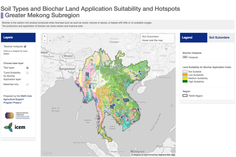
ICEM developed this interactive map of soil types and biochar suitability as part of the ADB-funded Biochar Assessment and Soil Mapping Study. The map allows users to toggle between an in-depth soil map and biochar suitability zones. Users can also zoom in, hover, and click on map elements for more information.

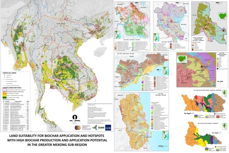
ICEM developed this land suitability for biochar application map for the Biochar Assessment and Soil Mapping Study.

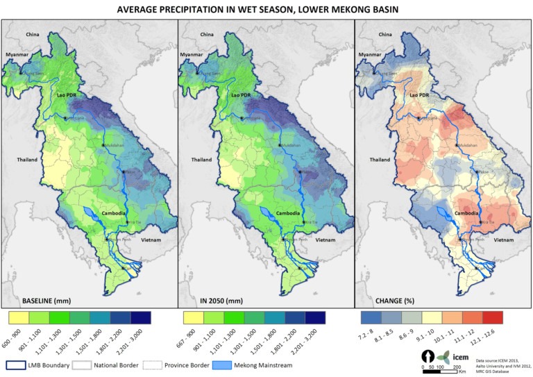
Much of ICEM’s work on the Mekong ARCC project hinged on climate modelling and maps created by ICEM’s GIS team. These maps covered temperature and precipitation projections for the Lower Mekong Basin. A selection of the precipitation maps are displayed below. Click on the map to download a high-resolution version.


RELATED PROJECTS