Developing Climate-Food-Nature Investments in the Pacific – Marine and terrestrial surveys for physical and biological aspects of the environment for five coastal communities in Fiji

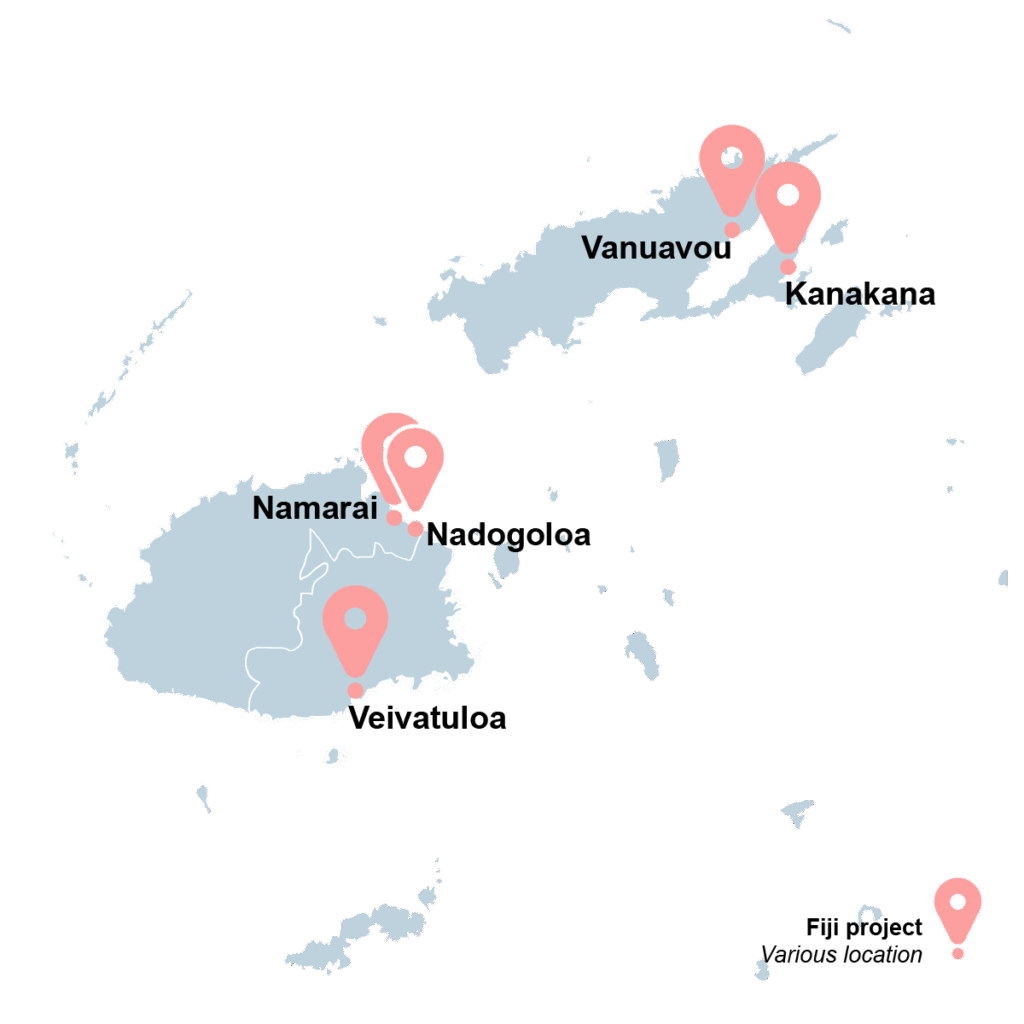
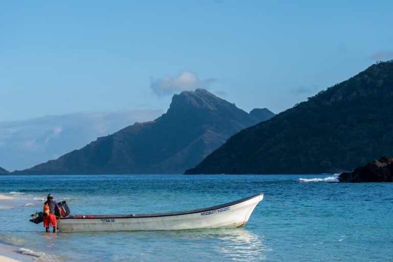
ADB is working with the Government of Fiji to design the Enhancing Climate Resilience of Coastal Communities Project (the Project) to provide enhanced climate-resilient protection and contribute to sustainable development of vulnerable coastal communities.

 A key component of the Project is to design hybrid coastal protection solutions for five coastal villages in Fiji, including rock revetments, temporary breakwaters, and mangrove replanting. To inform the detailed engineering design of the coastal protection solutions, ADB is engaging a service provider to conduct field surveys, i.e., marine and terrestrial surveys for physical and biological aspects of the environment.

client:
Asian Development Bank (ADB)
LOCATION:
Fiji
TIME:
May 2025
to June 2025

TAGS

Biodiversity, Project description
Fiji
Current Projects

Objectives, Activities and Results:

  • Compile all available technical data and conduct bathymetric and topographic field surveys at five coastal community sites in Fiji: Veivatuloa, Namarai, Nadogoloa, Kanakana, and Vanuavou. 
  • Design the field survey approach, including schedule, survey flight plans, dive site plans, bathymetry mapping, equipment requirements, and other technical specifications. 
  • Assess the distribution and types of marine habitats (e.g., coral reefs, seagrass beds, rock/rubble areas) using in-water video transects, spot surveys, drop camera assessments, and benthic sediment sampling. 
  • Set up the bathymetric survey system, follow predefined transects using a 12” Lowrance Carbon screen, and deploy an Aquadopp wave, current, and water level meter in shallow offshore areas. 
  • Apply tidal and offset corrections to the bathymetric data, digitize the results, and process Aquadopp sensor data. 
  • Conduct a beach topographic survey using a MAVIC drone with a predetermined profile, 8–12 ground control points (GCPs), and RTK base station/rover units. 
  • Perform kinematic processing of RTK GPS files using Emlid Studio, geotag drone imagery with GCP Editor Pro, process data in WEB ODM, and convert results to mean sea level (MSL). 
  • Prepare a final digital terrain model (DTM) based on processed topographic and bathymetric datasets.

RECENT PROJECTS