PROJECT NAME: WB Cambodia Mekong Delta Digital Atlas
About the project
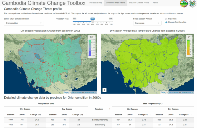
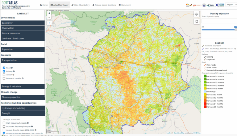
The Cambodia Mekong Delta Digital Atlas (also in short called the Atlas or CAM-MeDiA) provides a contemporary knowledge base to support decision making of national and subnational government officials responsible for planning in the Delta and for promoting transitions to more sustainable livelihoods. Unlike its downstream neighbor, Cambodia’s part of the Mekong Delta is less developed in terms of land and water use, rice cropping, and related infrastructure (e.g. low dykes/embankments, sluice gates). However, as Cambodia climbs the development ladder, policies and programs are being set in place, which include potential for irrigation expansion and possible unsustainable land-water use in the Delta. These decisions need to incorporate climate change (precipitation, temperature changes) and associated impacts of drought and flood, as well as impacts of upstream development, such as dams in Laos, and downstream development in Vietnam. Based on this information, it is likely that different solutions would be implemented, such as identifying areas where it is more beneficial to switch from three to two rice crops and/or adopt flood-based agriculture and aquaculture.