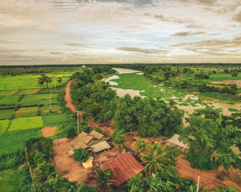
Project Description

Assessing the potential of nature-based solutions and green infrastructure for increasing water security and flood and drought resilience in selected watersheds

Client: The World Bank (WB)   |   Duration:  November 2022 – May 2023 |   Location: Cambodia

The Royal Government of Cambodia (RGC) is committed to improving the country’s water security. The National Water Resource Management and Sustainable Irrigation Strategy and Long-term Investment Plan (2019-2033) lays out the long-term vision and investment and institutional development plan for integrated water resources management and sustainable irrigation services with a total estimated investment of up to US$2.6 billion.

The World Bank (WB) is supporting the RGC to increase water security by preparing the Cambodia Water Security Improvement Project (CWSIP) (WB: P176615). The project is intended to support the RGC in implementing the strategic plan for improving water security at the river basin, water system and community levels. Increasing water security will require a comprehensive approach addressing long-term and short-term needs simultaneously, looking at both supply and demand issues, and placing greater emphasis on balancing water sustainability, efficiency and equity by considering economic, social and environmental aspects. An integrated approach looking at upstream and downstream solutions, including river infrastructure, nature-based solutions  (NBS), green infrastructure  (GI) and improved watershed and natural resources management, will be required to achieve this objective effectively and sustainably increase water security.

The “Assessing the potential of nature-based solutions and green infrastructure for increasing water security and flood and drought resilience in selected watersheds” assignment will support the CWSIP, Component 1 preparation by identifying NBS options to increase climate, flood, and drought resilience.

ICEM’s project team is providing the following services:

  • Activity 1 will assess flood and drought risks in selected parts of the eastern provinces of Cambodia by:

    • Preparation of a detailed GIS database of the watersheds
    • Preparation of baseline maps of land use, land cover (LULC), infrastructure, land tenure, ecosystems and socio-economics in the watersheds
    • Hydrological modelling of flood and drought impacts
    • Development of flood and drought hazard maps based on historical incidence and climate change
    • Detailed definition and mapping of degraded areas within the watersheds, including trend analysis
    • Hazard, climate change and vulnerability assessments for identified communities, ecosystems and infrastructure

  • Activity 2 will identify and prioritize NBS to mitigate flood and drought risks, and build climate resilience in priority areas through:

    • Stocktaking of existing good practices in NBS for flood and drought management
    • Assessment of priority areas and high potential NBS areas
    • Assessment of technical effectiveness of potential NBS
    • Preliminary cost-benefit analysis of NBS proposed for prioritization
    • Options analysis for different cost ranges of interventions
    • Participatory priority setting of NBS measures
    • Development of maps indicating priority areas, NBS measures and of each measure

  • Activity 3 will focus on conducting an economic valuation of hydrological services provided by the ecosystems in the selected watersheds. This will be achieved by comparing values of hydrological services in current conditions of the watersheds, under a do-nothing scenario that considers projected forest degradation and changes in LULC, and under a scenario where specific interventions are put in place to address the degradation and maintain/ enhance ecosystem services.

    Discover our projects on nature-based solutions