PROJECT NAME: ADB TA-9191 REG: Building Climate Change Resilience in Asia’s Critical Infrastructure
About the project
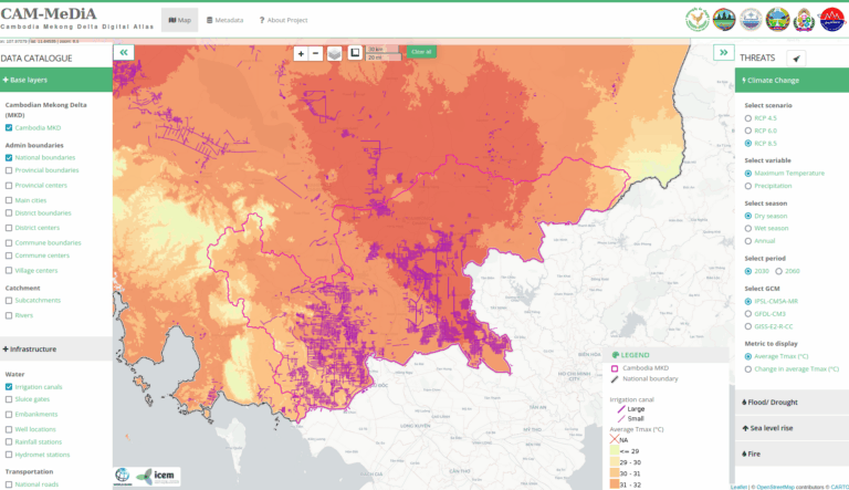
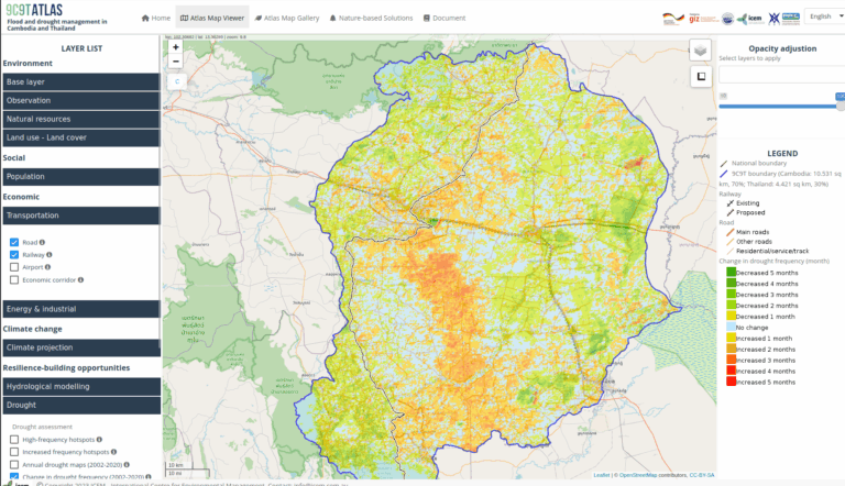
The TA9191 geospatial database provides a web-based Geospatial Information System (GIS) platform for visualizing existing critical infrastructure and climate change projections to support planning, investment, and development of resilient infrastructure in the energy, transport, and water sectors across South Asia and Southeast Asia. The web-based platform allows users to interact with critical infrastructure and climate change data to better understand how climate change affects critical infrastructure assets and complexes.
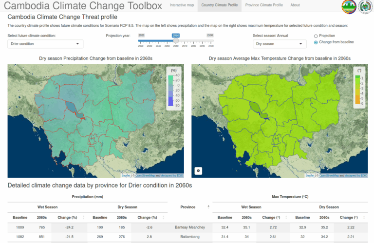
Climate change projections for temperature and precipitation can be selected and overlain with energy, transport, and water sector infrastructure data in the map viewer. Separate climate data layers are available for South Asia, Southeast Asia, Indonesia, Sri Lanka, and Viet Nam, reflecting the individual models selected for each spatial extent. The data can be selected for season (either wet/dry or northeast/southwest monsoon) and is available for both RCPs 4.5 and RCP 8.5. Climate change projections can be viewed as a continuous data set, or as “hot spot” data, where the data is divided into quintiles to highlight those areas projected to experience the highest relative changes.
By allowing users to spatially visualise impacts, users can also see how climate and other hazards can have external or result in a causal sequence of events to impact infrastructure even if the hot spot is located away from that infrastructure, and to facilitate landscape-scale planning through the visualization of spatial data at the regional, national, and catchment scales. In addition, selected infrastructure records are available in searchable tabular format as part of the data inventory.