Project Description
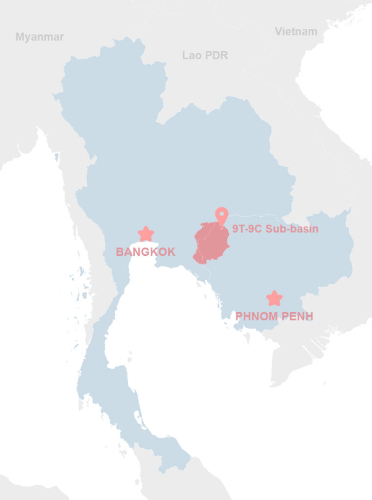
The 9C-9T sub-basin is a vital tributary of the Mekong River, shared by Thailand and Cambodia, supporting 1.4 million people and critical ecosystems linked to the Tonle Sap Lake. Its freshwater resources sustain agriculture, industry, biodiversity, and livelihoods, but are increasingly threatened by flood, drought, and climate change. The 9C-9T Joint Project, under GIZ’s Technical Cooperation for transboundary water governance in the Lower Mekong Basin (LMB), aimed to strengthen joint management and resilience through coordinated planning, monitoring, and investment. ICEM provided technical support during Phases II and III (2020–2024), focusing on planning, modelling, and early warning systems (EWS).
Objectives, Activities, and Results
ICEM supported the development of a transboundary flood and drought EWS across the 9C-9T sub-basin. Activities included stakeholder engagement, institutional assessments, design of the 9C-9T Basin Atlas and Flood and Drought Master Plan, and piloting of nature-based solutions. Phase III emphasized EWS design, capacity-building for local agencies and communities, and development of a gender-sensitive, cross-border monitoring network. ICEM facilitated national and regional consultations, finalized an upscaling strategy for replication in other LMB basins, and supported financing mobilization. The project strengthened bilateral cooperation, data sharing, and climate adaptation efforts in one of the Mekong region’s most critical transboundary basins.