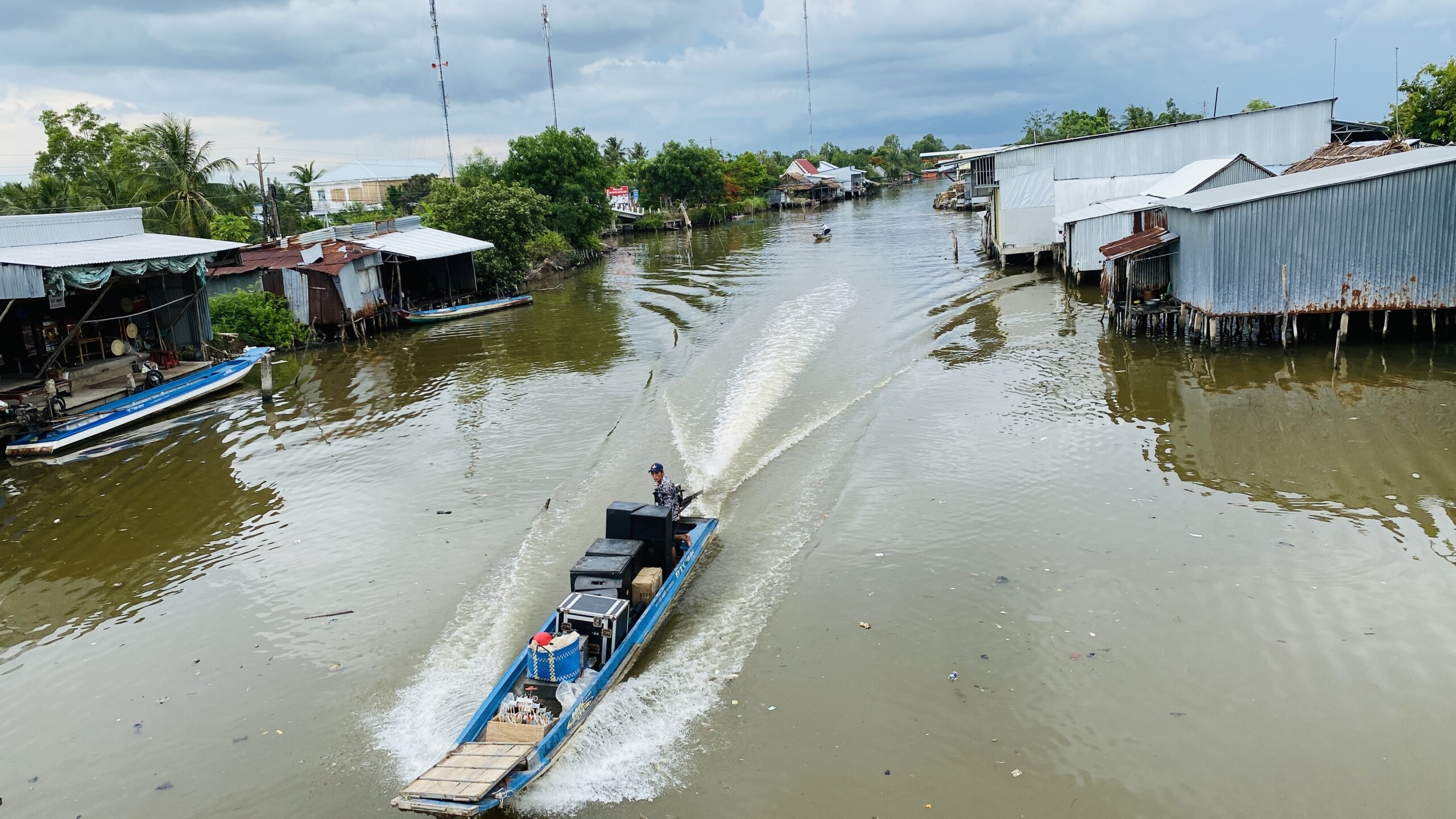
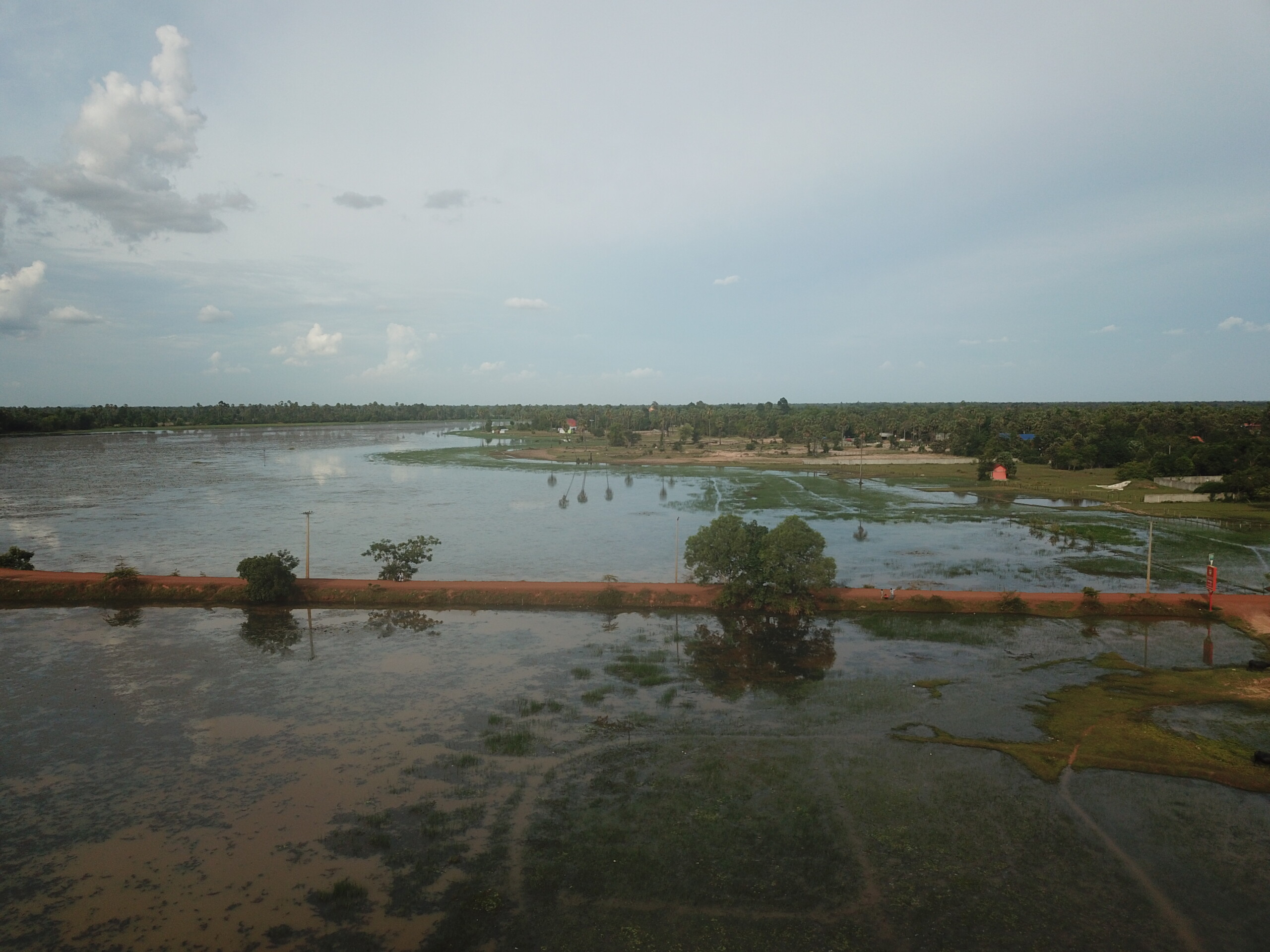
Drinking Water Supply Vulnerability in Vietnam’s Mekong Delta

BACKGROUND

The Mekong is one of the world’s great rivers. It is the third-largest river in Asia and the largest river in Southeast Asia. The source of the Mekong is located on the high Tibetan plateau in China. As the river flows downstream, it is joined by tributaries from Myanmar, Lao PDR, Thailand and Cambodia, eventually reaching its delta in Vietnam.

On average, every year about 460 billion cubic metres of water flows from the Mekong into Vietnam’s Mekong Delta Region.[1] However, despite receiving this enormous amount of water every year, the delta’s population of about 20 million people face many challenges in obtaining fresh water that is suitable for drinking and other domestic purposes. There are also concerns that the water insecurity these communities currently face could significantly worsen in the future due to climate change and other developments in the Mekong Basin.  The delta is Vietnam’s main agricultural centre, so water insecurities for communities living here could have implications for Vietnam’s food security and economy at a national level.

Due to these concerns, the World Bank, with support from the Global Facility for Disaster Reduction and Recovery and the Global Water Security and Sanitation Partnership contracted ICEM to undertake a vulnerability assessment for rural water supply systems in the Mekong Delta region under two steps, as discussed below.  The first step was to assess the vulnerability of the delta’s rural water supply systems, and the potential effects of climate change and regional development on these vulnerabilities in the future. The second step was to recommend ways to increase the resilience of water supply systems to these vulnerabilities.

STEP 1:  VULNERABILITY ASSESSMENT

Figure 1: Known rural drinking water systems in […]

Inception mission for project ‘Assessment for mainstreaming nature-based solutions in water supply sector’ in Cambodia

Over the last 30 years, there has been significant progress in ensuring that communities in Cambodia have access to reliable supplies of reasonable to good quality water in line with the 2003 Drinking Water Standard issued by the Royal Government of Cambodia (RGC). Yet, the coverage and capacity of water supply systems serving domestic users across Cambodia are still highly variable. Although larger cities have well-developed water supply infrastructure, there is still a lack of connectivity to water supply infrastructure in rural areas, with only 17% of rural households serviced by piped water supply facilities.

Overall, the water supply sector is highly exposed to seasonal flood and drought conditions which are becoming more severe due to widespread and increasing watershed degradation. Climate change, population growth, biodiversity loss and land-use change in watersheds of Cambodia present water supply systems with challenges in managing water quality and quantity.

Nature-based solutions (NBS) are an essential and cost-effective strategy for increasing resiliency to these stressors and generate a variety of co-benefits beyond the water sector by supporting poverty alleviation, community health and wellbeing, biodiversity protection, and climate mitigation.

Recognizing the values of NBS and supporting the RGC in strengthening the resilience of the water supply sector, the World Bank has engaged ICEM to conduct the project Assessment for mainstreaming nature-based solutions in the water supply sector. The project’s objectives are to explore the application of NBS in meeting the challenges and potential opportunities for sustainable water supply systems and to mainstream NBS in the water supply sector at operational and policy levels.

From the 10th to 22nd of June, 2022, the ICEM team undertook an inception mission for the project to the districts of Samaki Meanchey, Toek Phos (Kampong Chhnang province), and Prasat […]

By |2022-09-23T10:58:01+07:00September 23rd, 2022|Cambodia news, News, Water news|0 Comments

Mongolia Decision Support System training workshop: Part 1 – Water Governance Spatial Decision Support Tool

On 30th June, ICEM and IRIMHE convened the first of four workshop sessions for the Technical Assistance project funded by the Japan Fund for Poverty Reduction and High Technology Fund and administered by the Asian Development Bank – TA-9440 MON: Implementing Innovative Approaches for Improved Water Governance.

Objectives of the workshop sessions include providing an orientation of the key software and data components of the Mongolia Water Governance Spatial Decision Support Tool (DST) that is a key deliverable under the TA (https://dss.icem.com.au/mon9440); and to provide technical guidance in the management of the DST. This first workshop session was presented by Dr Richard Cooper (ICEM, TA International Database Management Specialist) and Ms Gurjav Batkhishig (IRIMHE, TA National Database Management Specialist).

The first workshop session invited representatives of multiple river basin authorities across Mongolia, including from the Kherlen, Orkhon-Chuluut, Altain Uvur Gobi, Tuul, Khüisiin govi-Tsetseg nuur, and Khar Nuur-Khovd river basins; and government staff members from IRIMHE and the Water Agency. Participants had the opportunity to learn about the key software and data components of the Mongolia Water Governance Spatial Decision Support Tool and gained practical experience in accessing and editing datasets from the State Water Database.

Future workshop sessions will provide further technical guidance on the management of the Decision Support Tool, including related to both the backend (GeoServer) and frontend (R Shiny) software components, and in managing its database. The DST contributes spatial data infrastructure to the Government of Mongolia in supporting the management of water resources by facilitating access, visualisation, and exploration of national water-related data and information.

Project details >>

By |2021-07-09T16:32:16+07:00July 9th, 2021|News, Water news|0 Comments

Drilling begins for Managed Aquifer Recharge pilot in Mongolia

Key progress is underway for the project Implementing Innovative Approaches for Improved Water Governance, with drilling beginning at the three managed aquifer recharge (MAR) pilot sites at Mogod, Baganuur and Gurvantes. The mission will be carried out over the next five to six weeks to identify aquifers and test water quality for the baseline study. During this time, the team will be camping on-site to monitor and supervise the drillers.


MAR is the intentional recharge of groundwater which considers water quality and quantity. It can facilitate sustainable water management by contributing directly to aquifer recharge, or indirectly by reducing demand for unsustainable groundwater sources by providing short term storage and then re-extraction of water.

Despite research into recharge processes and theoretical study, there have been no on-ground MAR trials in Mongolia. These MAR pilots constitute a promising technology that can form part of a suite of actions for greater sustainability of groundwater resources in Mongolia.

The broader aims of this project are to develop policy recommendations and updates to water laws and regulations to address current issues such as surface and groundwater scarcity, pollution from industrial activity, poor wastewater treatment and sanitation, ecosystem degradation and ageing infrastructure.

In Mongolia, despite a relatively sparse population, a lack of updated water governance combined with climate change and increased industrial activities has created serious pressures on water resources. Many households rely on untreated groundwater which may be contaminated.

Project details >>

50 years of international cooperation for the protection of wetlands

Every year on 2nd February, World Wetlands Day is celebrated to raise global awareness of the vital role of wetlands in maintaining the planet’s delicate ecosystems and the communities that depend on them. This year is particularly special – marking exactly 50 years since the adoption of the Convention on Wetlands in 1971, in the Iranian city of Ramsar on the Caspian Sea.

What is the Ramsar Convention?

The Ramsar Convention is an intergovernmental treaty that provides the framework for the conservation and cooperation around sustainable governance of wetlands and their resources. 90% of UN Member states across the world are a part of the Convention. Ramsar sites, or Wetlands of International Importance, are protected areas that are recognized as being of significant value not only for the country of their origin, but for the planet’s ecosystem health and biodiversity.

There are currently over 2,400 Ramsar Sites around the world, covering 2.5 million km.2

 Through designating a wetland as a Ramsar site, national governments demonstrate their commitment to take the necessary steps to safeguard the sites ecological integrity. International cooperation and national commitment to sustainable management of wetland areas can make a big difference.

For example, in Lake Chilika – the first designated Ramsar site in India – an ecological restoration program founded on participatory basin management has led to rapid recovery of wetland resources and aquatic biodiversity. Notably, there has been an increase in the number of critically endangered Irrawaddy dolphins, from only 89 in 2003, to 158 in 2014.[1]

 What is ICEM doing to protect wetlands?

Despite growing international action to protect the wetland sites, the vision of the Ramsar convention faces new and complex challenges from the impacts of a changing climate. Managing the […]

By |2021-02-03T09:51:12+07:00February 2nd, 2021|News, Uncategorized, Water news|0 Comments

Progress in times of COVID-19: Virtual inception for flood forecasting project in Myanmar

ICEM, along with partner JBA, is currently wrapping up an entirely virtual inception phase for a new project with the Department of Meteorology and Hydrology (DMH) in Myanmar – Impact Based Forecasting Pilots and Flood Hazard Mapping in the Chindwin and Central Ayeyarwady Basin. This has connected participants from multiple regions in Myanmar and eight other countries to progress impact based flood forecasting.

What is impact-based flood forecasting?

Flood forecasting for river systems provides crucial forewarning to communities about impending flood events. Currently, flood forecasts in Myanmar include information on the expected water level relative to defined ‘danger levels’. Impact based forecasting will take this to the next level with pilots in six towns located in the Chindwin and Central Ayeyarwady regions to provide valuable additional information about expected impacts such as:

Maps of flood inundation extent and hazard

Number of people exposed within the expected flood extent

Risk to critical infrastructure

This locally-relevant information further strengthens the ability of communities and governments to prepare for flood events before they occur. These pilots demonstrate best practice in line with the United Nations Sendai Framework for Disaster Risk Reduction 2015-2030 and World Meteorological Organization guidelines.

Implementing a virtual inception phase

Working within the current lock down conditions in many parts of Myanmar and around the world, the ICEM-JBA team worked closely with DMH staff to bring project management and stakeholders together safely via videoconference for two major events – the Kick-Off Meeting on 24 September and a User Requirements Workshop on 23 October. Strong communication was facilitated by providing full simultaneous interpretation between Myanmar and English languages during the main presentation and meeting discussions. During the workshop, a team of national staff also facilitated discussions in Myanmar language […]

By |2020-11-25T18:45:37+07:00November 17th, 2020|Myanmar news, News, Water news|0 Comments

Enhancing navigability on the Ayeyarwady River

The Ayeyarwady River in Myanmar is navigable for 1,280 km from the sea, opening a vast highway deep into the dry zone and interior of the basin. Between 261 and 364 million tons of sediment per year are transported through the river during the annual floods leading to erosion and deposition of the navigation channel, bars, islands and riverbanks. This means that some sections have insufficient water depth for inland waterway vessels to operate safely, as well as threatening agriculture along the river bank.

In view of the importance of inland waterway transport to the economic development of Myanmar, the World Bank funded Ayeyarwady Integrated River Basin Management Project (AIRBM), led by the Myanmar Directorate of Water Resources and Improvement of River Systems (DWIR) aims to support environmentally and socially sustainable improvements to navigability of the river. Stretch 1 (Mandalay to Nyaung U) was identified as a priority. Within this reach, a sub-project area (Subproject 1) was selected between the Mandalay port and Mingun area for construction of river training measures to maintain conditions for transport while avoiding negative environmental consequences.

Figure 1: Project area

From March-June 2018, March-June 2019, and November – February 2020, river training was carried out through bank protection measures (Figure 2: a combination of rip rap armor stones on geotextile, and vetiver grass) and hydraulic roughness measures in the form of concrete porcupines (Figure 3). The porcupines were installed to slow river flow and cause sediment deposition near river banks to prevent further erosion and stabilize and deepen the main navigation channel, also called the ‘Mandalay Channel’.

Figure 2: Bank protection works
Figure […]

Study on Hanoi water pollution and drainage management approaching closure

Hanoi has grown rapidly into a modern, vibrant city. It is also envisioned to become a centre of culture, science, education, economics, tourism and international trade in the Asia-Pacific region. However, the development of infrastructure and services has lagged behind the growth of the population, hindering the realization of such vision. In particular, sustainable water resources management is a major challenge. Water pollution and urban flooding have arisen as persistent environmental problems in Hanoi for years, impairing the liveability of the city, deterring investors and compromising social – economic development.

Hanoi City Drainage Master Plan addresses these two issues but its implementation has not kept pace with the growth of the problems. Making Hanoi a water pollution and flood free city by 2050 will require enormous and sustained investment and institutional reform.

In an effort to support Hanoi City to implement its Drainage Master Plan and to build resilience and sustainability in the City’s water resources management, in 2019, the World Bank commissioned ICEM to undertake a study on water pollution control and drainage and wastewater management in Hanoi. The study aims at developing an effective and comprehensive management and investment program to tackle water pollution in key rivers – To Lich, Nhue, Day and Tich, and improve drainage and wastewater management in prioritized locations – Long Bien and Gia Lam districts.

Through a series of stakeholder consultations, field inspections, and data analysis, the study team assessed the baseline conditions of water pollution in the four rivers and urban flooding and wastewater management in the two districts, delineated the causes, and identified bottlenecks in addressing such causes. The technical challenges include rapid population growth and urbanization, dwindling water resources in rivers, infrastructure deficit (i.e. shortage of wastewater […]

Historic day for Myanmar’s water governance with publishing of first reference book on hydrogeology

Hilton Hotel, Naypyidaw, Myanmar – 14th November

On the 14 November, a huge milestone in sustainable water governance in Myanmar was reached with the launching of the Myanmar language edition of the first-ever published reference book on hydrogeology in the country, ‘Hydrogeology of the Dry Zone – Central Myanmar’. The book launch, funded by the Australian Water Partnership (AWP), took place in Myanmar’s capital of Naypyidaw.

The book is a straightforward resource, containing hydrogeological data and maps which provide information such as the location of artesian basins, arsenic and saltwater, and the depth of drilling required in different locations.

Although the Dry Zone is endowed with abundant surface water from the Ayeyarwady River, most flows happen in the wet season. Away from the Ayeyarwady River, the Dry Zone suffers from extreme water shortages. Approximately 75 per cent of the population in the Dry Zone rely on groundwater for drinking and domestic purposes. Villagers without tubewells travel great distances to collect water from shallow dugwells and polluted earth ponds, often leading to water-borne diseases. Accordingly, the provision of reliable, clean water supply to this area has been identified as a developmental priority.

The original English volume was a culmination of 30 years of Dr Len Drury’s work (Aqua Rock Konsultants) with assistance from the Groundwater Division, Irrigation and Water Utilization Management Department (IWUMD) of the Ministry of Agriculture, Livestock and Irrigation (MOALI). The figures and maps were digitised by ICEM, and the text peer-reviewed by the International Water Management Institute (IWMI).

Dr Len Drury (right) looking over photos from the original study in Myanmar’s Central Dry Zone in 1980s

Although finished in 1988, the book was not published at the time […]

Publications released for Environmental Study of the Lancang-Mekong Development Plan

The Mekong River is one of the world’s great rivers, flowing through six countries –PR China, Myanmar, Lao PDR, Thailand, Cambodia and Viet Nam. It has unique and irreplaceable biodiversity, and is essential to the livelihoods of the approximately 60 million people living in the Lower Mekong Basin.

In February 2016, the Joint Committee on Coordination of Commercial Navigation on the Lancang-Mekong River gave conditional approval for the Development Plan of International Navigation on the Lancang-Mekong River – a complex transboundary project including the upgrading of several cargo ports; the partial clearing of 146 rapids, rocky outcrops and shoals to allow navigation for up to 500DWT vessels between Simao, PR China and Luang Prabang, Lao PDR; the construction of four emergency response and rescue ships; and the promotion of increased shipping, trade and passenger transport from Yunnan province to Luang Prabang.

There are potential significant long-term social and environmental impacts of the LMDP from port construction, increased waterway use and the partial removal of rapids and shoals. As the LMDP does not currently include a comprehensive environmental management plan, the Critical Ecosystems Partnership Fund (CEPF) allocated funding to ICEM to conduct an Environmental Study of the LMDP from the Golden Triangle to Luang Prabang, and of the proposed Pak Beng hydropower project, located on the Lancang-Mekong River in northern Lao PDR.

The project included a period of scoping to determine key issues for biodiversity and socio-economics. It then assessed the baseline situation in the eight project themes (hydrology and sediment, aquatic biodiversity and wetlands, birds, fish, amphibians and reptiles, waterways and socio-economics) to identify key trends in each. This was followed by an impact assessment of the LMDP and Pak Beng HPP on each of the trends and […]

By |2020-01-10T15:21:36+07:00October 29th, 2019|Lao PDR news, News, Water news|0 Comments

Strengthening Integrated Water Resource Planning and Management in Thailand: Completion of Phase One

Record flooding in 2011 took a heavy toll on Thailand, leading to an estimated $45 billion worth of damage, large swathes of agricultural and residential land inundated, millions left homeless or displaced, and over 9,000 factories forced to temporarily close. In the wake of the disaster, there were calls for more integrated planning of flood and water resources management to avoid such catastrophic impacts of extreme weather in the future.

Aligning with this goal, since 2017, ICEM has been supporting Thailand’s Department of Water Resources (DWR) with the development of an Integrated Water Resources Management (IWRM) modeling tool to understand the impact of different management strategies and contribute to the development of basin-wide master plans.

An important part of the project has been capacity building. Between August 2017 and June 2018, DWR staff from central and regional levels received training on how to use the modelling tool and applied it to two pilot sites: Eastern Coast River Basins and Nam Phong River Basin. Trainees learned how to process all input data required for building a model, and tested possible scenarios addressing flood, climate change, water allocation, crop and reservoir management.

Training workshop (left); input data set for the Eastern Coast River Basins model (right)

Strengthening the capacity in effective integrated water resource management will have a significant impact on Thailand’s ability to create sustainable and climate resilient solutions that mitigate against disaster and protect livelihoods within river basins.

Four key outputs were produced as part of Phase I of the project – the IWRM User Guide (translated into Thai), which provides step by step instructions on how to use the IWRM modelling tool; two reports presenting preliminary findings […]

ICEM hosts session at Annual Greater Mekong Forum on Water, Food and Energy in Yangon

Yangon, Myanmar – 6th December 2018

On the 4-6th of December 2018, the Inya Lake Hotel in Yangon hosted the 6th annual Greater Mekong Forum on Water, Food and Energy. This year, around 30 organizations held sessions on a diverse range of topics, from smart innovations for better decision making in Deltas from the Delft University of Technology, Improving Forest-Fungi Systems Agroforestry from the Kunming Institute of Botany, to cross-border water cooperation through sub-national and community-led initiatives in the Ganges and Mekong basins from Oxfam.

Hydropower was a recurring theme – from Oxfam’s session about civil society perspectives of the Strategic Environmental Assessment of Hydropower in Myanmar to a session from Spectrum SDKN about Gender and Resettlement at the Upper Paunglaung Relocation Villages in Myanmar.

This year, ICEM hosted a session under the sub-theme ‘innovative water governance’ on the role of environmental assessment tools in achieving sustainability and resilience in river basin development. Three studies were presented: the SEA of hydropower in Myanmar, SEA of the Lancang-Mekong river development plan, and the ESIA of river training works on the Ayeyarwady, downstream of Mandalay and a panel debate with three regional experts. The presentations aimed to answer three key questions: what lessons can be drawn from these studies to guide future SEA/ESIAs, what are the outstanding issues for resolution and concern, and what are some priority developments which would benefit from these assessment tools. There was great audience participation and enthusiastic discussion, with a key takeaway being the need for greater, and meaningful participation of local people.

ICEM also presented case studies of climate change impact and vulnerability at seven wetland sites on the Mekong at the ‘ShareFair’ poster exhibition space. The case studies are part of the “Basin-wide Climate […]

Myanmar Healthy Rivers Initiative project reports and publications available

Yangon, Myanmar –  August 31, 2018: Myanmar Healthy Rivers Initiative project reports and publications available

Myanmar’s rivers are a key national resource, providing irrigation, hydropower, water supplies for cities and industries, and navigation and transport routes. They are also important ecosystems, supporting productive fisheries both inland and in the deltas, and underpinning the livelihoods of Myanmar communities. As Myanmar develops, aquatic ecosystems are under pressure from changes to the river systems, necessary to foster economic growth, but impacting on the ecosystem services and products provided by rivers.

The Myanmar Healthy Rivers Initiative (MHRI) aimed to develop and test a river health framework which allows government and communities to monitor the status of the riverine ecosystem services they value, and provides evidence for informed, integrated water resource management (IWRM) planning. The project focused on Myanmar’s two iconic rivers; the Ayeyarwady, and the Thanlwin.

The project was recently completed, and all reports and publications produced are now available to view and download. Among others, these include river basin health report cards, river health monitoring frameworks, community river health surveys and a community river health monitoring manual. A characterization of the hydro-ecological zones of the Ayeyarwady River basin, and state of knowledge reports for both basins are also included.

View and download all project publications

ICEM’s project portfolio in South Asia expands

Building on an already extensive track record of experience in South Asia, the ICEM project portfolio in the region has recently expanded with two more projects, building on experience in Nepal and now also including Bhutan. ICEM also added one more project to its current portfolio of projects in Myanmar.

Myanmar hydropower SEA Final Report draft available for review and comment

Yangon, Myanmar –  May 22, 2018: Myanmar Hydropower SEA Final Draft Report available for review and comment

The Strategic Environmental Assessment (SEA) of the hydropower sector in Myanmar, draft Final Report is now available for review and comment. The SEA focuses on the country’s hydropower potential while mapping out environmental and social complexities. The SEA will identify opportunities to sustain natural river basin processes that regulate and maintain river health and other ecosystems services.

A key recommendation outlined in the SEA is to preserve the mainstems of Myanmar’s key rivers, including the Ayeyarwady, Thanlwin and Chindwin, encouraging decision makers to explore locations that carry less environmental, social and cultural risk.

“Recommending to protect the mainstems of Myanmar’s key rivers would be a monumental achievement with multiple socio-economic benefits, keeping the natural ecosystems of our country. We hope to see this recommendation moved forward by decision makers,” said U Hla Maung Thein, Director General, Environmental Conservation Department, Ministry of Natural Resources and Environmental Conservation (MONREC). “Our department has reviewed the SEA final report and recommendations, and we agree with the direction it is pointing hydropower development in.”

According to Daw Mi Mi Khaing, Director General of Department of Electric Power Planning, Ministry of Electricity and Energy (MOEE), “this is the first time we have a basin-wide perspective on environmental and social values, which will help decision makers better site hydropower projects.”

Once finalised, the SEA Final Report will be published online in English and Myanmar. A concise summary will also be made available in select ethnic languages.

Download the draft SEA Final Report Feedback should be returned in the supplied comment matrix Deadline for comment is close of business (Yangon) […]

Framework to assess river health in Myanmar presented

Nay Pyi Taw, Myanmar –  March 9, 2018: Framework to assess river health in Myanmar presented

As Myanmar develops, pressure on the country’s rivers is increasing. With limited data available to inform management decisions, sustainable development of these key national resources is challenging. In response, the Myanmar Healthy Rivers Initiative (MHRI) was launched; an applied research project designed to help government and communities explore different techniques to monitor river health and inform sustainable management of the rivers and the ecosystem services they supply.

Launched in 2015, the project is managed by the International Centre for Environmental Management (ICEM) with the International Water Management Institute (IWMI) and local partners Ecosystem Conservation and Community Development Initiative (ECCDI) and Myanmar Institute for Integrated Development (MIID). The project team work with the Ministry of Natural Resources Environment and Conservation (MONREC) and consulted a wide range of stakeholders from national to community level. Support and funding is provided by the WLE Greater Mekong Program and the Australian Government.

This March, final river health monitoring indicators, tools and results were presented to core government partners at the project’s final workshop. The event was also an opportunity to explore next steps and considerations for implementation and up-scaling of the Myanmar River Health Framework, a resource kit which includes characterisation of the main users, uses and values of river systems; a set of simple environmental indicators specifically designed to monitor changes and trends in these uses; a set of assessment tools and approaches; and guidelines on how to implement and analyse river health monitoring and reporting.

Community representatives presenting results of river health event calendars at the MHRI final workshop.

The framework was developed with a range of […]

Notice of public consultation for draft ESIA/ESMP of Sub-Project 1 of the AIRBMP

The Directorate of Water Resources and Improvement of River Systems (DWIR) is considering a combination of river training structures and dredging to improve year-round and safe accessibility to the port of Mandalay. ICEM has been engaged to prepare the Environmental and Social Impact Assessment (ESIA) and Environmental and Social Management Plan (ESMP) for Subproject 1.

The project is part of the World Bank funded Ayeyarwady Integrated River Basin Management Project (AIRBMP), which aims at finding and implementing technical and operational schemes for making improvements of the navigability of the Ayeyarwady River Basin. The goal is “to improve inland water transport in priority stretches of the Ayeyarwady River and design a cost-effective and environmentally and socially acceptable strategy for managing the full length of the navigation channel”.

Public consultation for the draft ESIA and ESMP for Subproject 1 will take place on Thursday, 18 January at the Triumph Hotel in Mandalay at 08:45 am.

The objectives of the public consultation for the draft ESIA/ESMP for Subproject 1 are to:

  • Present an overview of Component 3 of the AIRBMP and Subproject 1;
  • Outline the technical solutions and detailed designs for Subproject 1 based on the results of modeling and simulations;
  • Review the key findings of the draft ESIA/ESMP of Subproject 1;
  • Discuss stakeholder issues and opportunities to be included in the final ESIA/ESMP for Subproject 1; and
  • Outline next steps in relation to the implementation of the Draft ESIA/ESMP and Subproject 1.

The overall objectives of Subproject 1 are to achieve a Least Available Depth (LAD) of 2.0 m for a design of 1,000 dead weight tonne. The river training works and dredging will allow vessels to pass more heavily loaded during dry season, increasing the efficiency of passenger and […]

Major study on hydrogeology of Myanmar’s Dry Zone published

Approximately 15.4 million people, just under 30 % of the population of Myanmar, live in Myanmar’s Dry Zone. Most villages, towns and cities rely on groundwater for potable water supplies, and away from the Ayeyarwady River and tributaries, the Dry Zone is extremely short of water. Villagers without tubewells travel great distances to collect small quantities of water from shallow dugwells and polluted earth ponds.

By |2020-01-10T15:21:40+07:00November 17th, 2017|Myanmar news, News, Water news|0 Comments

Baseline information on Ayeyarwady River gathered from local communities

The Ayeyarwady is one of the most important of Myanmar’s rivers for economic development, yet relatively little is still known about this key waterway. Team members of component three of the Myanmar Ayeyarwady Integrated River Basin Management (AIRBM) project, recently turned to local community members to fill some of the gaps in information necessary to inform the future development of the river.

By |2020-01-10T15:21:40+07:00August 25th, 2017|Myanmar news, News, Water news|0 Comments

Public invited to discuss planned Ayeyarwady River improvements

The Directorate of Water Resources and Improvement of River Systems (DWIR) is considering a combination of river training structures and dredging to improve year-round and safe accessibility to the port of Mandalay. ICEM has been engaged to prepare the Environmental and Social Impact Assessment (ESIA) and Environmental and Social Management Plan (ESMP) for Subproject 1.

The draft scoping reports for the ESIA and ESMP for Subproject 1 are now available for public comment. To meet the requirements of the Myanmar EIA procedures (2015) and World Bank safeguard policies a Public Consultation meeting will be conducted on Friday 4th August, 2017 in Mandalay to review the Draft Scoping Report. The scoping reports are part of component three of the Myanmar Ayeyarwady Integrated River Basin Management (AIRBM) project. Managed by DWIR with support from the World Bank, the AIRBM project aims to develop and enhance navigation for the full navigable length of the river from Mandalay to Yangon. Navigation is proposed to be enhanced by river training by constructing groynes, guide bunds etc. in the river channel, bank protection works, dredging and installation of navigation aids such as signage, buoys and lighting.

The ESIA will assess the baseline and potential impacts of river improvement works and lead to the preparation of an ESMP and a monitoring framework for the developments. This will ensure that measures are put in place to avoid and mitigate impacts and enhance the sub-project benefits. The environmental and social impacts of sub-project 1 will need to be considered during both the construction and operational phases.

In compliance with the Myanmar EIA procedures (2015) and World […]

Further steps taken to establish country-wide river basin modelling tool for Thailand

Thailand has long recognised that river basin modelling provides important evidence to inform basin planning and integrated water resources management (IWRM). Flood management is closely linked with the broader issues of river basin planning and IWRM, and the need to strengthen it has become urgent after the severe floods of 2011, which affected almost 14 million people across 65 of Thailand’s 77 provinces.

New data collected for Ayeyarwady River

New data on key infrastructure, social indicators and environmental issues are being gathered and updated for the Ayeyarwady River between Mandalay and Nyaung Oo. The data will contribute to an environmentally and socially acceptable strategy for managing the future development of inland water transport (IWT) in Myanmar.

Myanmar hydropower SEA draft Baseline Assessment Report now available for public comment

Yangon, Myanmar –  June 8, 2017: Myanmar hydropower SEA draft Baseline Assessment Report now available for public comment

*UPDATE: The deadline for public review has been extended to 20 July 2017

The draft Baseline Assessment Report for the Strategic Environmental Assessment (SEA) of the Hydropower Sector in Myanmar is now available for public review. The document (presented in eight separate chapters) will be available from today (8 June) until 22 June 2017. Following this review period, the baseline chapters will undergo a final round of revisions and comments will be included in the annex. The release of the draft chapters follows on a series of national, basin and local level stakeholder consultations, during which sustainability principles and key themes were refined in order to identify the key strategic environmental and social issues for each river basin.

The SEA comprises three main phases:

  • Scoping and baseline assessment
  • Impact assessment and sustainability analysis
  • Mitigation and recommendations

The scoping and baseline assessment phase led to the preparation of three volumes:
1. Stakeholder Engagement Plan
2. Regional River Basin Consultations – Key Findings
3. Baseline Assessment Report

The draft Baseline Assessment Report, which is now available for review, consists of the following chapters:

Chapter 1: Introduction
Chapter 2: Hydropower
Chapter 3: Geomorphology and sediment transport
Chapter 4: Biodiversity
Chapter 5: Aquatic ecology and fisheries
Chapter 6: Economic development and land use
Chapter 7: Social and livelihoods
Chapter 8: Conflict

Download the draft Baseline Assessment Report chapters Send your comments to Rory Hunter at rory.hunter@icem.com.au For more information, visit the SEA of the Hydropower Sector in Myanmar project page Download the Stakeholder Engagement Plan Report Download the Regional River Basin Consultations Report

[…]

Socio-economic and environmental trends in 3S river basins discussed at regional meeting

What have we learned so far? What are the gaps to be highlighted? And what are the inter-relationships of the issues concerned? These are the questions that were answered during the recent dialogue between government and NGO representatives of the Lower Mekong Basin (LMB) countries and technical experts from regional organisations.

Trade-offs in 3S river basins deliberated

The Sekong, Sesan and Sre Pok basins are richly endowed with natural resources and support the livelihoods of an estimated 3.5 million people living in Cambodia, Lao PDR and Vietnam.  In early-March, potential trade-offs among development decisions in the 3S basins, and their social, economic and environmental risks were the topic of a dialogue involving government representatives of the Lower Mekong Basin (LMB) countries and technical experts from regional organisations.

ICEM Director General published in handbook of significant scholarly debates

ICEM Director General, Dr Jeremy Carew-Reid contributed a chapter on strategic environmental assessment of mainstream hydropower development in the Mekong to the recently published Routledge Handbook of the Environment in Southeast Asia.

3S River Basins Study set to begin

The Sekong, Sesan and Sre Pok are transboundary tributaries of the Mekong River. The 3S basins, as they are collectively known, are richly endowed with natural resources and make an important contribution to national and regional development while supporting the livelihoods of 3.5 million people living in Cambodia, Laos and Vietnam. However, there is a critical need to understand and respond to the risks inherent in the current "growth at all costs" paradigm.

L-CRVA Kicks Off in Sekong and Saravane Provinces, Lao PDR

The Lao PDR Climate Risk and Vulnerability Assessments for Rural Infrastructure (L-CRVA) kicked off with a series of working sessions and field missions in southern Laos. The project, which aims to build capacity in assessing the climate risk and vulnerability of water infrastructure systems in Sekong and Saravane provinces.

By |2020-01-10T15:21:46+07:00September 15th, 2015|Lao PDR news, News, Water news|0 Comments

Depth of ICEM Experience in Rivers to be Featured in 18th Annual International RiverSymposium

Tarek Ketelsen, ICEM Technical Director, will present as a keynote speaker at this year's International RiverSymposium to be held in Brisbane, Australia. Held annually, this premier event brings together river managers, policy developers, scientists, consultants, NGOs and community organisations to share knowledge and innovative ideas on all aspects of river and water management. The theme for this year's Symposium is “Healthy Rivers – Healthy Economies”.

By |2020-01-10T15:21:46+07:00August 19th, 2015|News, Water news|0 Comments

ICEM Participates in 2015 FOSS4GNA Geospatial Conference in San Francisco

SAN FRANCISCO, CALIFORNIA – 9 – 12 March, 2015: ICEM Participates in 2015 FOSS4GNA Geospatial Conference in San Francisco

ICEM presented at this year’s FOSS4GNA in San Francisco. FOSS4GNA is one of the largest global gatherings focused on open source geospatial software. It brings together developers, users, decision-makers and observers from a broad spectrum of organizations and fields of operation to foster the development of and support for open source geospatial software in a variety of fields.

The presentation focused on ICEM’s map Impact of Water Supply Infrastructure on Floods and Droughts in the Mekong Region, which was built as part of the Optimising Cascades project. This interactive map highlights results of a study of 67 Mekong dams for indicators such as flood control capacity and natural flood threat of the dam’s catchment. Users are given the option to change which indicator they are viewing at any given time, thus changing the overall picture of floods and dams in the basin. Each map element contains deeper data and information.

The presentation highlighted in particular the Lower Se San Dam, which coincided well with the keynote delivered by Planet Labs, whose high-resolution satellite imagery recently captured the dam’s rapid construction.

FOSS4GNA also afforded the opportunity to develop connections with Development Seed. Development Seed’s work focuses mainly on humanitarian aid, however, its OpenDataKit collection of software, originally designed to gather spatial and on-the-ground information in refugee camps in Lebanon, will likely prove very effective in ICEM’s upcoming projects on the Salween and Irrawaddy rivers in […]

By |2020-01-10T15:21:48+07:00March 23rd, 2015|ICEM team news, News, Water news|0 Comments

ICEM workshop on Nam Ngiep 1 climate vulnerability brings with it a number of firsts

In 2014, Nam Ngiep 1 Power Company (NNP1PC) commissioned ICEM to undertake a climate change risk and vulnerability assessment (CRVA) of their Nam Ngiep 1 hydropower facility. The NNP1 CRVA was to be the first comprehensive assessment of climate change impacts to a hydropower facility in Lao PDR and the Mekong Region, and one of the first few comprehensive studies worldwide. The overall objective of the study was to assess the climate risk of the proposed Nam Ngiep Hydropower 1 Project (NNP1) in Lao PDR, and to identify measures to increase its climate resilience.

By |2020-01-10T15:21:48+07:00February 28th, 2015|Mekong news, News, Water news|0 Comments

ICEM Brings Spatial Expertise to Mekong Delta Forum

ICEM Brings Spatial Expertise to Mekong Delta Forum The Mekong Delta Forum, co-hosted by MARD, MONRE, World Bank, Australian Aid, Kingdom of the Netherlands, was held in Ho Chi Minh City over February 2 & 3, 2015. The Forum brought together experts, dignitaries, and professionals to address the "what" and "why" of:

Initial Field Mission Establishes Groundwork, Implements Hydraulic Monitoring Program in Khone Falls Channels

ICEM hydrologists have been undertaking field monitoring and training with researchers from WorldFish, the National University of Lao (NUoL), and Ubon Ratchathani Universtiy (UBU). The project Informing Fish Passage in the Mekong River aims to assess the swimming capabilities of migratory fish species in the Khone Falls, Chapasak in Southern Laos.

ICEM holds National Workshop on Strategic Environmental Assessment (SEA) in Thailand

On December 13th and 14th 2014, ICEM, the Asian Development Bank (ADB), the Thai Government’s National Economic and Social Development Board (NESDB) hosted a National Workshop on Strategic Environmental Assessment (SEA) in Thailand at the Woraburi Ayothaya Convention Resort in Ayutthaya.

By |2020-01-10T15:21:49+07:00December 30th, 2014|News, Thailand News, Water news|0 Comments

National Workshop on Strengthening Integrated Water and Flood Management Implementation in Thailand

BANGKOK, THAILAND – 2-3 July 2014: ICEM and ADB host the National Workshop on Strengthening Integrated Water and Flood Management Implementation in Thailand

On July 2nd and 3rd 2014, ICEM and the Asian Development Bank (ADB) hosted the National Workshop on Strengthening Integrated Water and Flood Management Implementation (IWRM) in Thailand at the Eastin Grand Sathorn Hotel in Bangkok. The workshop was held to promote awareness and consensus on the issues, tools and processes for improving water resource management in Thailand’s river basins, in particular flood and drought prevention and mitigation and water pollution control.

Over the two days, representatives and key personnel from major water management agencies at the national and provincial level, as well as international organisations and the private sector collaboratively discussed and worked through the opportunities and obstacles to IWRM in Thailand.

The workshop saw dynamic presentations and panel discussions about the future of water resource planning in Thailand. Key presentations included:

  • The Application of Satellite Monitoring Tools in Water Resource Management
    Anond Snidvongs – Director General of the Geo-informatics and Space Technology Development Agency (GISTDA)
  • Economic Planning at River Basin Level to Achieve Sustainable Resource Use
    Ladawan Kumpa – Deputy Secretary General of the Office of the National Economic and Social Development Board (NESDB)
  • Using Managed Aquifer Recharge
    Sittisak Manyou – Senior Geologist of the Department of Groundwater Resources on Mitigation of Floods, Drought and Groundwater Level Declination in Sukhothai, Phitsanulok and Phichit Provinces
  • How to maintain sustainability in water resources and natural systems while achieving flood and drought protection
    Songtam Suksawang – Director of the Research Division, Department of National Parks, Wildlife and Plant Conservation (DNP)

Robert Mather, IUCN

To reduce flood threats, Nepal builds climate risk into planning

ICEM's Mainstreaming Climate Risk Management in Development project has been featured in a recent article by the Thomson Reuters Foundation. Published as part of the Foundation's Human Impact series, the article outlines actions of the ADB-funded project and Nepal's government to coordinate efforts across ministries to build climate resilience into infrastructure planning.

Go to Top